วันอาทิตย์ที่ 5 มิถุนายน พ.ศ. 2554

หอศิลป์ ณ ศิลปากรวังท่าพระ*


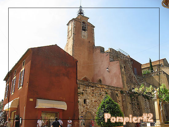
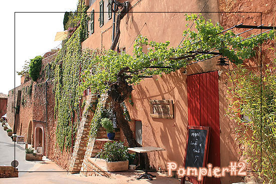
  วังท่าพระเดิม คือ วังตะวันตกริม ถนน หน้าพระลาน ตั้งอยู่ข้างพระบรมมหา ราชวังด้านทิศตะวันตก ใกล้ท่าช้าง ชื่อ “วังท่าพระ” เรียกตาม สถานที่ ที่ตั้งอยู่ใกล้กับประตู ท่าพระที่ปรากฏตามพระราชพงศาวดารว่า “เมื่อ พ.ศ. 2351 พระบาทสมเด็จพระพุทธยอดฟ้า จุฬาโลก มหาราช ได้โปรดเกล้าฯ ให้อัญเชิญพระพุทธรูป องค์ใหญ่ คือ พระศรีศากยมุนี จากวิหารหลวงวัดมหาธาตุ เมืองสุโขทัย ล่องแพมายังกรุงเทพฯ เพื่อ นำมา ประดิษฐาน ณ วิหารหลวงวัดสุทัศน์เทพวราราม ที่ทรงสร้างขึ้นใหม่ ครั้นอัญเชิญ ชักพระขึ้นจากแพทาง ประตูท่าช้าง ไม่สามารถ เข้าประตูได้จึงต้องรื้อกำแพงประตู ซึ่งต่อมาก็เรียกประตูท่าช้างนี้ว่า “ประตูท่าพระ” ชื่อวังนี้ จึงเรียกกันว่า “วังท่าพระ” ตั้งแต่นั้นมา”


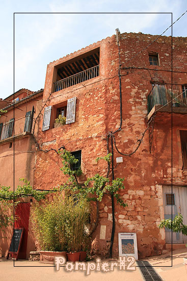
              วังท่าพระ เป็นวังที่พระบาทสมเด็จพระพุทธยอดฟ้าจุฬาโลก (รัชกาลที่ 1) ทรงโปรดฯ ให้สร้างขึ้นเพื่อ พระราชทานแก่พระราชนัดดา คือ สมเด็จพระเจ้าบรมวงศ์เธอ เจ้าฟ้ากรมขุนกษัตรานุชิต ซึ่งเรียกกันว่า เจ้าฟ้าเหม็นสำหรับเป็นที่ประทับเป็นพระองค์แรก ต่อมาในสมัยพระบาทสมเด็จพระจุลจอมเกล้าเจ้าอยู่หัว (รัชกาลที่ 5) ได้พระราชทานวังท่าพระให้สมเด็จเจ้าฟ้ากรมพระยานริศรานุวัดติวงศ์ และทรงโปรด ให้ซ่อมแซม ท้องพระโรงและก่อสร้างตำหนักกลาง และตำหนักพรรณราย ในรูปแบบอาคารแบบ ผสมผสานระหว่างศิลปะ ตะวันออกและ ตะวันตกดังที่ปรากฏในปัจจุบัน และได้มีการซ่อมแซมปรับปรุงต่อมาหลายครั้ง และในปี พ.ศ. 2529 ก็ได้มีการปรับปรุง ซ่อมแซมหลังจากได้มีการจัดตั้งเป็นหอศิลป์แล้ว และได้รับรางวัลอาคาร อนุรักษ์ดีเด่น จากสมาคม สถาปนิกสยามใน พระบรมราชูปถัมภ์ ในปี พ.ศ. 2532 และต่อมาในปี พ.ศ. 2540 ได้มีการ ซ่อมแซม ปรับปรุงส่วนต่างๆ ของหอศิลป์ ที่มีการชำรุดทรุดโทรมให้มีสภาพ สมบูรณ์ขึ้นเพื่อรองรับการ จัดแสดงนิทรรศการ การจัดสัมมนา และอบรมทางด้านศิลปะได้อย่างมีประสิทธิภาพต่อไป


***  ท้ายสุดขอแถมรูปเจ้าของบล็อคและเพื่อนเจ้าของบล็อคค่ะ (เห่อชุด นศ.ค่ะ อยากโชว์)   555   ปล.นศ. หญิงคณะโบราณที่วังท่าพระนี่ใส่กระโปรงยาวเกือบทุกคนค่ะ   ตัวเจ้าของบล็อคเองด้วยความไม่ชินเผลอเหยียบชายกระโปรงตัวเองตอนลุกจากที่นั่งไปหลายทีเหมือนกัน = ="


วันจันทร์ที่ 17 มกราคม พ.ศ. 2554

New York City ~*


"New York, New York" and "NYC" redirect here. For other uses, see New York, New York (disambiguation) and NYC (disambiguation).

This article is about the city. For other uses, see New York City (disambiguation).


From top left: Midtown Manhattan, the United Nations Headquarters, the Statue of Liberty, Times Square, the Unisphere in Queens, the Brooklyn Bridge, and Lower Manhattan with the Staten Island Ferry

New York is the most populous city in the United States and the center of the New York metropolitan area, which is one of the most populous metropolitan areas in the world. New York City has a significant impact on global commerce, finance, media, culture, art, fashion, research, education, and entertainment. As host of the United Nations Headquarters, it is also an important center for international affairs. The city is often referred to as New York City or the City of New York, to distinguish it from the state of New York, of which it is a part.


Located on a large natural harbor on the Atlantic coast of the Northeastern United States, New York City consists of five boroughs: The Bronx, Brooklyn, Manhattan, Queens, and Staten Island. With a 2009 estimated population approaching 8.4 million residents distributed over a land area of just 305 square miles (790 km2), New York City is the most densely populated major city in the United States.As many as 800 languages are spoken in New York City, making it the most linguistically diverse city in the world.The New York metropolitan area's population is the United States' largest, estimated at 19.1 million people distributed over 6,720 square miles (17,400 km2). The New York metropolitan area is part of a Combined Statistical Area that contained 22.2 million people as of 2009 Census estimates, the largest combined statistical area in the United States.


New York traces its roots to the 1624 founding of New Amsterdam as a trading post by Dutch colonists. The city and its surrounds came under English control in 1664, and was renamed New York after the English King Charles II granted the lands to his brother, the Duke of York. New York served as the capital of the United States from 1785 until 1790. It has been the country's largest city since 1790.

Many districts and landmarks in New York City have become well known to outsiders. The Statue of Liberty greeted millions of immigrants as they came to America by ship in the late 19th and early 20th centuries. Times Square, iconified as "The Crossroads of the World", is the brightly illuminated hub of the Broadway theater district, one of the world's busiest pedestrian intersections, and a major center of the world's entertainment industry. New York City's financial district, anchored by Wall Street in Lower Manhattan, vies with London as the financial capital of the world and is home to the New York Stock Exchange, the world's largest stock exchange by market capitalization. The original Manhattan Chinatown attracts throngs of tourists to its bustling sidewalks and retail establishments. Numerous colleges and universities are located in New York, including Columbia University, New York University and Rockefeller University, which are ranked among the top 100 in the world

วันอังคารที่ 30 พฤศจิกายน พ.ศ. 2553

Mont Saint-Michel *


Mont Saint-Michel  is a rocky tidal island and a commune in Normandy, France. It is located approximately one kilometre (just over half a mile) off the country's north coast, at the mouth of the Couesnon River near Avranches. The population of the island is 41.

Mont-Saint-Michel was used in the sixth and seventh centuries as an Armorican stronghold of Romano-Breton culture and power, until it was ransacked by the Franks, thus ending the trans-channel culture that had stood since the departure of the Romans in AD 460.


The mount gained strategic significance in 933 when William "Long Sword", William I, Duke of Normandy, annexed the Cotentin Peninsula, definitively placing the mount in Normandy. It is depicted in the Bayeux Tapestry which commemorates the 1066 Norman conquest of England. Harold, Earl of Wessex is pictured on the tapestry rescuing two Norman knights from the quicksand in the tidal flats during a battle with Conan II, Duke of Brittany. Norman Ducal patronage financed the spectacular Norman architecture of the abbey in subsequent centuries.


In 1067, the monastery of Mont-Saint-Michel gave its support to duke William of Normandy in his claim to the throne of England. It was rewarded with properties and grounds on the English side of the Channel, including a small island located to the west of Cornwall, which was modeled after the Mount, and became a Norman priory named St Michael's Mount of Penzance.

During the Hundred Years' War, the English made repeated assaults on the island, but were unable to seize it due to the abbey's improved fortifications. Les Michelettes – two wrought-iron bombards left by the English in their failed 1423–24 siege of Mont-Saint-Michel – are still displayed near the outer defense wall.

When Louis XI of France founded the Order of Saint Michael in 1496, he intended that the abbey church of Mont Saint-Michel be the chapel for the Order, but because of its great distance from Paris, his intention could never be realized.


Le Mont St. Michel, map with bilingual, Latin and French, historical description, engraved late XVIII century or early XIX century. Typographical characters suggest XVIII century.The wealth and influence of the abbey extended to many daughter foundations, including St Michael's Mount in Cornwall. However, its popularity and prestige as a centre of pilgrimage waned with the Reformation, and by the time of the French Revolution there were scarcely any monks in residence. The abbey was closed and converted into a prison, initially to hold clerical opponents of the republican régime. High-profile political prisoners followed, but by 1836, influential figures – including Victor Hugo – had launched a campaign to restore what was seen as a national architectural treasure. The prison was finally closed in 1863, and the mount was declared a historic monument in 1874. The Mont-Saint-Michel and its bay were added to the UNESCO list of World Heritage Sites in 1979, and it was listed with criteria such as cultural, historical, and architectural significance, as well as human-created and natural beauty


Mont-Saint-Michel Abbey, albumen print, ca. 1865-1895Before the construction of the first monastic establishment in the 8th century, the island was called "monte tombe". According to legend, the Archangel Michael appeared to St. Aubert, bishop of Avranches, in 708 and instructed him to build a church on the rocky islet. Aubert repeatedly ignored the angel's instruction, until Michael burned a hole in the bishop's skull with his finger.

วันพุธที่ 24 พฤศจิกายน พ.ศ. 2553

ล่องเรือไปใน เวนิส*


เวนิส (Venezia) เมืองที่โรแมนติกติดอันดับต้นๆ ของโลก “เมืองที่ใช้เรือแทนรถ ใช้คลองแทนถนน” มีเกาะเล็กใหญ่กว่า 118 เกาะ และมีสะพานเชื่อมมากกว่า 400 แห่ง
การท่องเที่ยวแนะนำให้ไปเช้าๆ เราจะได้บรรยายกาศยามเช้า อากาศเย็น อีกอย่างหนึ่งก็คือ ช่วงสายเป็นด้นไป นักท่องเที่ยวจะเยอะมากๆ


ศิลปะที่สวยงานในเมืองเวนิส

เวนิสเป็นเมืองหลวงของแคว้นเวเนโต ประเทศอิตาลี เมืองเวนิสได้รับฉายาว่า ราชินีแห่งทะเลอาเดรียตริก(Queen of the Adriatic), เมืองแห่งสายน้ำ (City of Water), เมืองแห่งสะพาน (City of Bridges), และเมืองแห่งแสงสว่าง (The City of Light)

เมืองเวนิสถูกสร้างขึ้นจากการเชื่อมเกาะเล็กๆ จำนวนมากเข้าด้วยกันในบริเวณทะเลสาบเวนิเทีย ซึ่งเป็นส่วนหนึ่งของทะเลอาเดรียตริก ในภาคเหนือของประเทศอิตาลี
 

มีความเชื่อมาว่า ถ้าคู่รักได้จูบกัน เมื่อตอนระฆังปาไนล์ดังตอนเย็น ขณะลอดข้ามสะพานถอนหายใจ
ถือว่าคนนั้นจะรักกันยืนนาน

สะพานถอนหายใจ (Bridge of Sigh) สะพานนี้ใช้เดินข้ามเพื่อไปเข้าคุกที่อยู่อีกฝั่ง วิวที่เห็นจากสะพานนี้จะเป็นวิวที่สวยงามของเมืองเวนิส แสงสว่างที่เห็นจากช่องสะพาน นักโทษจะได้เห็นเป็นครั้งสุดท้ยก่อนเข้าคุก และจะถอนหายใจด้วยเหตุผลนี้ เพราะรู้ตัวว่าจะไม่มีโอกาสเดินออกมาเห็นแสงสว่างอีกแล้ว
ตามประวัติมีอยู่คนเดียวที่ได้ออกมาเขาคือ… คาสโนว่า นักรักผู้ยิ่งใหญ่

 
เรือกอนโดลา (Gondola) เป็นเรือพายพื้นบ้านของชาวเวนิส ใช้เป็นพาหนะหลักของการเดินทางในเมืองเวนิส ประเทศอิตาลี มานานหลายร้อยปี และเป็นสัญลักษณ์ของเวนิสไปซะแล้ว ถ้าได้ไปเวนิส ต้องไม่พลาดที่จะได้ไปล่องเรือกอนโดลา เพื่อชมเมืองเวนิส


เวนิสมีสินค้าท้องถิ่นที่ขึ้นชื่อ คือ เครื่องแก้วมูราโน หน้ากากเซรามิค และผ้าลูก ไม้ จากเกาะบูราโน เป็นอุตสาหกรรมครอบครัวที่มีประวัติยาวนานสืบทอดกันมา และกลายเป็น สัญลักษณ์ของเมืองเวนิส

Credit :: Mr. Know
ล่องเรือกอนโดลา ชมเมืองเวนิส

เรือกอนโดลา อีกสัญลักษณ์หนึ่งของเวนิส

วันอาทิตย์ที่ 31 ตุลาคม พ.ศ. 2553

เที่ยวโพรวองซ์ ( Provence ) ที่ ... LOURMARIN


Loumarin อยู่ทางด้านเหนือของ Aix en Provence ขับรถขึ้นไปประมาณ 42 กิโลเมตร ใช้เวลาเพียงประมาณ 42 นาทีเท่านั้น

ภาพแรกที่เห็นเด่นเป็นสง่าอยู่นั่นคือ Château de Lourmarin (ชา-โต้-เดอ-ลู-มา-คัง) ซึ่งเป็นประสาทเก่าแก่สร้างขึ้นโดย Foulques d'Agoult ขุนนางของโพรวองซ์ในยุคนั้น โดยส่วนที่เก่าที่สุดนั้นเริ่มสร้างมาตั้งแต่ ศตวรรษที่ 15 สร้างขึ้นบนซากปรักหักพังของป้อมปราการเก่า

Lourmarin เป็นหมู่บ้านซึ่งตั้งอยู่ในเขตการปกครอง le département de Vaucluse และ la région Provence-Alpes-Côte d'Azur ที่นี่เป็นหมู่บ้านโพรวองซ์ขนาดเล็กๆ มีประชากรพันกว่าคนเท่านั้นเอง

วันนี้อากาศดีมาก ปลายเดือนกันยายนอย่างนี้เป็นช่วงที่ดีของการท่องเที่ยว อากาศกำลังเย็นสบายเพราะใกล้จะเข้าหน้าหนาวแล้ว ยิ่งในโพรวองซ์นี่ตอนกลางวันๆแดดจะดียิ่งทำให้การเดินท่องเที่ยวสบายหมู่บ้านนี้ ร้านค้าจึงค่อนข้างเยอะเพื่อเอาใจ และเอาตังค์บรรดานักท่องเที่ยวทั้งหลาย รู้สึกว่าในโพรวองซ์นี่ การไปเที่ยวไม่ว่าจะเมืองใหญ่หรือแม้แต่หมู่บ้านเล็กขนาดไหน ก็ล้วนแต่มีร้านให้ Shopping ทั้งสิ้น ..จึงเตือนไว้สำหรับใครที่จะมา ก็ต้องเก็บหอมรอมริบกันไว้ให้ดีๆ


Lourmarin ถ้าเดินไปทางไหนบ้านเรือนก็มีสีสัน โดยเฉพาะบรรดาประตู หน้าต่าง หลากสีฉูดฉาดในแบบ โพรวองซ์หนอโพรวองซ์ จริงๆ ..สมกับที่ได้รับคัดเลือกให้เป็น "หนึ่งในหมู่บ้านที่สวยที่สุดของฝรั่งเศส" เหมาะกับการท่องเที่ยวแบบเดินเล่นสบายๆ ไม่วุ่นวายมากนัก...
 ด้านบน ขวามือ L’église de Lourmarin เป็นโบสถ์ประจำหมู่บ้าน มีขึ้นตั้งแต่ศตวรรษที่ 11 เก่าแก่ไม่เบา..
แต่ว่าเดือน ก.ย.ที่ไปนี้ สำหรับฝรั่งเองเค้าจะเลิกเที่ยวกันแล้ว เพราะพวกเค้าเที่ยวกันอย่างเมามันไปหมดแล้วตั้งแต่ช่วงเดือน ก.ค. และ ส.ค. จึงเป็นผลดีต่อเราที่คู่แข่งในการท่องเที่ยวจะไม่มากนัก...เดินสบาย ถ่ายรูปสบาย กินก็สบาย

ด้านบนสังเกตดีๆจะเห็นว่า หมู่บ้านนี้ บรรดาป้ายร้านต่างๆจะมีลักษณะไม่เหมือนที่อื่น มีศิลปะ สวยงาม

วันพฤหัสบดีที่ 7 ตุลาคม พ.ศ. 2553

เมืองสีแดงแห่งโพรวองซ์ ที่ Roussillon *


Roussillon  อยู่ในเขตการปกครองที่เรียกว่า Département du Vaucluse มีประชากรเพียงแค่ ประมาณ 1200 คน สูงจากระดับน้ำทะเล 345 เมตร


ด้านบนนี้ก็เป็นหอระฆัง มีนาฬิกาด้วย...เป็นประตูเมืองเก่าแก่ ช่วงศตวรรษที่ 19 ก็ถูกเปลี่ยนแปลงให้เป็นมุมหนึ่งของโบสถ์ประจำเมือง


วันอาทิตย์ที่ 5 กันยายน พ.ศ. 2553

เที่ยวกันอีกแล้ว * Les Baux de Provence งดงามมาก!!


วันนี้จะพาทุกท่านไป Les Baux de Provence อ่านว่า เล-โบ-เดอ-โพ-วองซ์ กันค่ะ ^^"


Les Baux de Provence อยู่ทางทิศตะวันตกขึ้นไปทางเหนือเล็กน้อย ของ Aix-en-Provence


สำหรับหมู่บ้านนี้นั้นมีประวัติศาสตร์ยาวนาน โดยมีการพบร่องรอยการมาอยู่อาศัยของมนุษย์มากว่า 6000 ปี...ในสมัยยุคกลาง Les Baux มีความยิ่งใหญ่ใช้ได้ครับ ปกครองเมืองและหมู่บ้านโดยรอบถึง 79 เมือง...มีป้อมปราการที่ถูกสร้างขึ้น ระหว่าง ศตวรรษที่ 9-13 ...และ Les princes des Baux (เจ้าชายแห่ง Les Baux) ยังเป็นถึงผู้ปกครองแห่งโพรวองซ์อยู่นานหลายปี


ต่อมา ใน ค.ศ.1642 Les Baux de Provence ได้ถูกยกให้เป็นของราชวงศ์ Grimaldi (la famille Grimaldi) ซึ่งเป็นราชวงศ์กษัตร์ย์แห่งโมนาโกในปัจจุบัน...และยังสืบทอดต่อกันเรื่อยมา... จนกระทั้งปัจจุบันนี้ แม้ว่า Les Baux de Provence จะอยู่ภายใต้การปกครองของฝรั่งเศส ...แต่ทางประเพณีนิยมแล้ว กษัตริย์ Albert II (อัลแบร์ ที่ 2) แห่งโมนาโก ซึ่งเป็นกษัตริย์พระองค์ปัจจุบันนี้ ยังทรงถือเป็นหนึ่งในขุนนางแห่ง Les Baux


ลักษณะเด่นอีกประการคือ หมู่บ้านนี้จะเต็มไปด้วย ร้านค้า* ที่ขายของที่ระลึก สไตล์โพรวองซ์ ให้เราได้เลือกซื้อไปใช้หรือเป็นของฝากได้เป็นอย่างดี แต่ละร้านก็มีการตกแต่งอย่างสวยงาม
สำหรับวันนี้ จะเน้นพาเดินเล่นชมบ้านชมเมือง และร้านสวยๆของหมู่บ้านนี้นะค่ะ


อย่างที่บอกไปแล้วว่าที่นี่เมืองมีแขกมาเยี่ยมเยียนก็จะพามาเที่ยวประจำ นอกจากเราที่คิดเช่นนี้แล้ว บรรดานักท่องเที่ยวเค้าก็คิดเช่นเดียวกัน ทำให้หมู่บ้านนี้เต็มไปด้วย คนชอบเที่ยว* ที่เดินกันขวักไขว่


หมู่บ้านนี้อยู่ใน อันดับที่ 18 ของรายชื่อสถานที่ท่องเที่ยวที่คนไปเที่ยวกันมากที่สุดของประเทศฝรั่งเศส...และในแต่ละปี ที่นี่ต้อนรับนักท่องเที่ยวมากกว่า 2,000,000 คน